Súbor:Autoroute A10.jpg
Nie je dostupné vyššie rozlíšenie.
Autoroute_A10.jpg (640 × 480 pixelov, veľkosť súboru: 54 KB, MIME typ: image/jpeg)
Zhrnutie
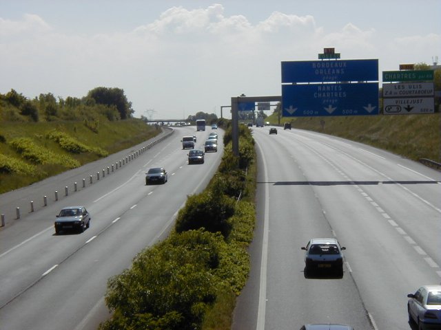
| Popis |
Français : L'autoroute A10 à la hauteur de Villebon-sur-Yvette, dans l'Essonne (France). Sur le panneau, on peut lire les directions de Bordeaux, Orléans, Nantes et Chartres. |
| Dátum | |
| Zdroj | Vlastné dielo |
| Autor | Arnaudus |
Licencovanie
| Ja, držiteľ autorských práv k tomuto dielu, uvoľňujem toto dielo ako voľné dielo (public domain). Toto platí celosvetovo. V niektorých krajinách to zákon neumožňuje; v tom prípade: Udeľujem komukoľvek právo používať toto dielo na ľubovoľné účely, bez akýchkoľvek podmienok ak také podmienky nevyžaduje zákon. |
Pôvodný záznam nahrávaní
| date/time | username | edit summary |
|---|---|---|
| 5 juin 2004 à 09:35 | Template namespace initialisation script | |
| 20 mai 2004 à 20:49 | Arnaudus | (Licence & Auteur) |
| 20 mai 2004 à 20:48 | Arnaudus | (== Autoroute A 10 ==) |
História súboru
Po kliknutí na dátum/čas uvidíte ako súbor vyzeral vtedy.
| Dátum/Čas | Náhľad | Rozmery | Používateľ | Komentár | |
|---|---|---|---|---|---|
| aktuálna | 16:44, 14. október 2012 | | 640 × 480 (54 KB) | Olybrius | Reverted to version as of 20:32, 18 January 2005 |
| 16:44, 14. október 2012 |  | 640 × 480 (54 KB) | Olybrius | Reverted to version as of 20:32, 18 January 2005 | |
| 07:36, 14. jún 2007 |  | 640 × 480 (141 KB) | Grondin | Correction des niveaux d'entrées des couleurs. Utilisation de GIMP 2.3.18 | |
| 20:32, 18. január 2005 |  | 640 × 480 (54 KB) | Michiel1972 | {{PD}} - From FR.wik: Prise de vue à la hauteur de Villebon-sur-Yvette, dans l'Essonne. Sur le panneau, on peut lire les directions de Bordeaux, Orléans, Nantes et Chartres. |
Použitie súboru
Na tento súbor odkazuje nasledujúca stránka:
Globálne využitie súborov
Nasledovné ďalšie wiki používajú tento súbor:
- Použitie na ba.wikipedia.org
- Použitie na be-tarask.wikipedia.org
- Použitie na be.wikipedia.org
- Použitie na bg.wikipedia.org
- Použitie na bs.wikipedia.org
- Použitie na ca.wikipedia.org
- Použitie na cs.wikipedia.org
- Použitie na de.wikipedia.org
- Použitie na el.wikipedia.org
- Použitie na en.wikipedia.org
- Použitie na en.wikivoyage.org
- Použitie na es.wikipedia.org
- Použitie na et.wikipedia.org
- Použitie na eu.wikipedia.org
- Použitie na ext.wikipedia.org
- Použitie na fa.wikipedia.org
- Použitie na fr.wikipedia.org
- Použitie na hr.wikipedia.org
- Použitie na hu.wikipedia.org
- Použitie na it.wikipedia.org
- Použitie na it.wikivoyage.org
- Použitie na ko.wikipedia.org
- Použitie na nl.wikipedia.org
- Použitie na nn.wikipedia.org
- Použitie na no.wikipedia.org
- Použitie na pl.wikipedia.org
- Použitie na ru.wikipedia.org
- Použitie na sh.wikipedia.org
Zobraziť ďalšie globálne použitie tohto súboru.