Súbor:Location map United Kingdom City of Lancaster.svg

Veľkosť tohoto PNG náhľadu tohoto SVG súboru: 535 × 600 pixelov. Iné rozlíšenia: 214 × 240 pixelov | 428 × 480 pixelov | 685 × 768 pixelov | 913 × 1 024 pixelov | 1 827 × 2 048 pixelov | 1 164 × 1 305 pixelov .
Pôvodný súbor (SVG súbor, 1 164 × 1 305 pixelov, veľkosť súboru: 5,03 MB)
Zhrnutie
| Popis |
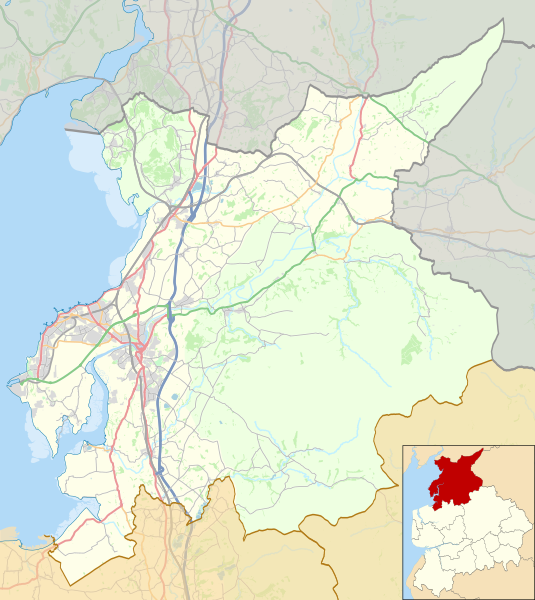
English: Map of the City of Lancaster district, Lancashire, England.
Equirectangular map projection on WGS 84 datum, with N/S stretched 165% Geographic limits:
|
| Dátum | 22:51, updated 2017-05-03 |
| Zdroj |
Tento soubor byl odvozen z: |
| Autor |
|
| Ďalšie verzie |
|

.svg)
Licencovanie
| This work contains information from OpenStreetMap, which is made available under the Open Database License (ODbL).
The ODbL does not require any particular license for maps produced from ODbL data. Prior to 1 August 2020, map tiles produced by the OpenStreetMap Foundation were licensed under the CC-BY-SA-2.0 license. Maps produced by other people may be subject to other licences. |
Tento súbor podlieha licencii Creative Commons Attribution-Share Alike 2.0 Generic
Uvedenie autora: © OpenStreetMap contributors. © Natural England copyright 2012. Contains Ordnance Survey data © Crown copyright and database right 2012.
- Môžete slobodne:
- zdieľať – kopírovať, šíriť a prenášať dielo
- meniť ho – upravovať dielo
- Za nasledovných podmienok:
- uvedenie autorov – Musíte spomenúť autorov (jednotlivo alebo kolektívne), poskytnúť odkaz na licenciu a uviesť, či ste niečo zmenili. Môžete to urobiť ľubovoľným primeraným spôsobom, ale nie spôsobom naznačujúcim, že poskytovateľ licencie podporuje vás alebo vaše použitie diela.
- meniť za rovnakých podmienok – Ak toto dielo zmeníte, prevediete do inej formy alebo použijete ako základ iného diela, musíte výsledok šíriť pod rovnakou alebo kompatibilnou licenciou ako originál.
História súboru
Po kliknutí na dátum/čas uvidíte ako súbor vyzeral vtedy.
| Dátum/Čas | Náhľad | Rozmery | Používateľ | Komentár | |
|---|---|---|---|---|---|
| aktuálna | 21:43, 7. máj 2018 | | 1 164 × 1 305 (5,03 MB) | Dr Greg | Some minor colour changes to improve clarity |
| 21:27, 3. máj 2017 |  | 1 164 × 1 305 (5,06 MB) | Dr Greg | Added Heysham link road | |
| 22:06, 25. júl 2014 |  | 1 164 × 1 305 (5,03 MB) | Dr Greg | User created page with UploadWizard |
Použitie súboru
Na tento súbor odkazuje nasledujúca stránka:
Globálne využitie súborov
Nasledovné ďalšie wiki používajú tento súbor:
- Použitie na ar.wikipedia.org
- Použitie na azb.wikipedia.org
- Použitie na en.wikipedia.org
- Lancaster, Lancashire
- Leighton Moss RSPB reserve
- Galgate
- Heysham
- Carnforth
- City of Lancaster
- Clougha Pike
- Grit Fell
- Ward's Stone
- Wolfhole Crag
- Bolton-le-Sands
- Capernwray Hall
- White Hill (Forest of Bowland)
- Hawthornthwaite Fell
- Lancaster railway station
- Carnforth railway station
- Silverdale railway station
- Silverdale, Lancashire
- Melling-with-Wrayton
- Heysham Port railway station
- Morecambe railway station
- Bay Horse
- Cockerham
- Halton-with-Aughton
- Abbeystead
- Wennington, Lancashire
- Yealand Conyers
- Yealand Redmayne
- Yealand Storrs
- Arkholme-with-Cawood
- Quernmore
- Whittington, Lancashire
- Borwick
- Overton, Lancashire
- Middleton, Lancashire
- Sunderland, Lancashire
- Wennington railway station
- Slyne-with-Hest
- Dolphinholme
- Warton, Lancaster
- Green Hill (Lancashire)
- Cowan Bridge
- Burrow-with-Burrow
- Wray, Lancashire
- Hornby Castle, Lancashire
- Cockersand Abbey
Zobraziť ďalšie globálne použitie tohto súboru.