Súbor:Crozet Map.png
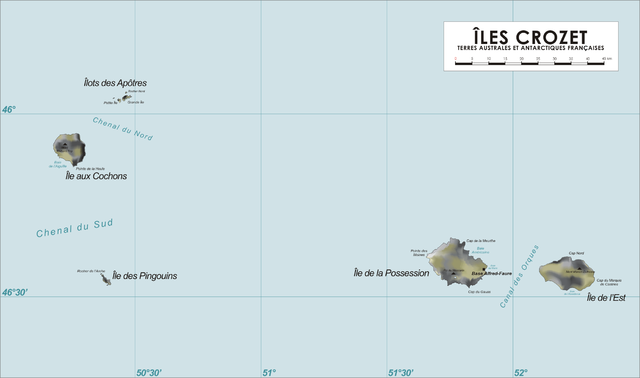
Veľkosť tohto náhľadu: 800 × 473 pixelov. Iné rozlíšenia: 320 × 189 pixelov | 640 × 378 pixelov | 1 024 × 605 pixelov | 1 280 × 757 pixelov | 2 280 × 1 348 pixelov .
Pôvodný súbor (2 280 × 1 348 pixelov, veľkosť súboru: 246 KB, MIME typ: image/png)

|
Tento obrázek (skupina map) by měl být vytvořen pomocí vektorové grafiky jako SVG soubor. To má několik výhod; podrobnosti najdete na stránce Commons:Media for cleanup. Je-li SVG verze tohoto obrázku již k dispozici, prosím nahrajte ji. Po nahrání nahraďte tuto šablonu šablonou {{Vector version available|jméno nového obrázku.svg}}.
|
Zhrnutie
| Popis |
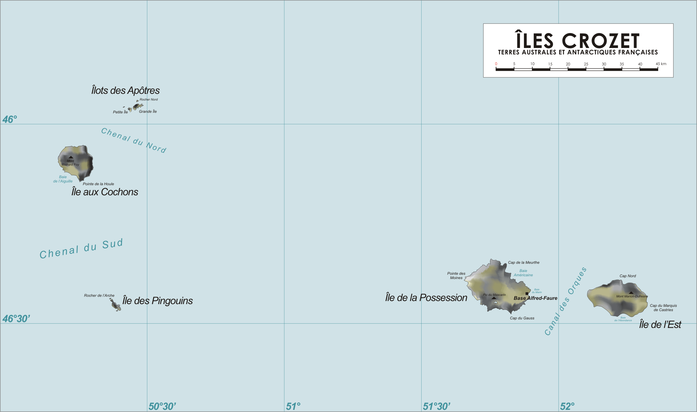
Map of the Crozet Islands, French Southern and Antarctic Territories
|
| Dátum | 13. apríla 2006 (datum prvotního načtení souboru) |
| Zdroj | No machine-readable source provided. Own work assumed (based on copyright claims). |
| Autor | No machine-readable author provided. Varp~commonswiki assumed (based on copyright claims). |
Licencovanie
| Ja, držiteľ autorských práv k tomuto dielu, uvoľňujem toto dielo ako voľné dielo (public domain). Toto platí celosvetovo. V niektorých krajinách to zákon neumožňuje; v tom prípade: Udeľujem komukoľvek právo používať toto dielo na ľubovoľné účely, bez akýchkoľvek podmienok ak také podmienky nevyžaduje zákon. |
História súboru
Po kliknutí na dátum/čas uvidíte ako súbor vyzeral vtedy.
| Dátum/Čas | Náhľad | Rozmery | Používateľ | Komentár | |
|---|---|---|---|---|---|
| aktuálna | 18:55, 13. apríl 2006 | | 2 280 × 1 348 (246 KB) | Varp~commonswiki | |
| 11:45, 13. apríl 2006 |  | 2 280 × 1 348 (242 KB) | Varp~commonswiki | *Map of the Crozet Islands, French Southern and Antarctic Territories *drawn by varp |
Použitie súboru
Na tento súbor odkazuje nasledujúca stránka:
Globálne využitie súborov
Nasledovné ďalšie wiki používajú tento súbor:
- Použitie na af.wikipedia.org
- Použitie na ar.wikipedia.org
- Použitie na ast.wikipedia.org
- Použitie na az.wikipedia.org
- Použitie na bg.wikipedia.org
- Použitie na br.wikipedia.org
- Použitie na ca.wikipedia.org
- Použitie na cs.wikipedia.org
- Použitie na da.wikipedia.org
- Použitie na de.wikipedia.org
- Použitie na de.wikivoyage.org
- Použitie na el.wikipedia.org
- Použitie na en.wikipedia.org
- Použitie na en.wikivoyage.org
- Použitie na eo.wikipedia.org
- Použitie na es.wikipedia.org
- Použitie na eu.wikipedia.org
- Použitie na fi.wikipedia.org
- Použitie na fr.wikipedia.org
- Archipel Crozet
- Marc Joseph Marion du Fresne
- Île aux Cochons
- Île des Pingouins
- Îlots des Apôtres
- Île de la Possession
- Île de l'Est
- Base Alfred-Faure
- Terres australes et antarctiques françaises
- Mont Marion-Dufresne
- Pic du Mascarin
- Mont Richard-Foy
- Mont des Manchots
- Mont Pierre
- Julien Crozet
- Baie Américaine
- Tamaris (voilier)
- Lac Perdu (archipel Crozet)
- Vallée de l'Au-delà
- Guillaume Lesquin
Zobraziť ďalšie globálne použitie tohto súboru.