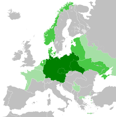
Súbor:Greater German Reich (1942).svg

Veľkosť tohoto PNG náhľadu tohoto SVG súboru: 450 × 456 pixelov. Iné rozlíšenia: 237 × 240 pixelov | 474 × 480 pixelov | 758 × 768 pixelov | 1 011 × 1 024 pixelov | 2 021 × 2 048 pixelov .
Pôvodný súbor (SVG súbor, 450 × 456 pixelov, veľkosť súboru: 594 KB)


.svg)
.svg)
.svg)
.svg)
.svg)


.svg)
.svg)
.svg)


.png)
.png)


.svg)


.svg)

.svg)


.svg)
.svg)
.svg)
.svg)


.svg)
.png)


.svg)


.svg)
.svg)


.svg)


.svg)


.svg)
.svg)
.svg)
.svg)
.svg)
.svg)
.svg)
.svg)
_cropped.svg)
.svg)
.svg)
.svg)
.svg)
.svg)
.svg)
.svg)
.svg)
.svg)
.svg)
.svg)
.svg)
.svg)
.svg)
.svg)
.svg)
.svg)
.svg)
.svg)
.svg)
.svg)
.svg)
.svg)
.svg)
.svg)
.svg)
.svg)
.svg)
.svg)
.svg)
.svg)
.svg)
.svg)
.svg)
.svg)
.svg)
.svg)
.svg)
.svg)
.svg)
.svg)
.svg)
.svg)
.svg)
.svg)
História súboru
Po kliknutí na dátum/čas uvidíte ako súbor vyzeral vtedy.
.svg&dir=prev)
.svg&offset=20180422235102)
.svg&offset=&limit=20)
.svg&offset=&limit=50)
.svg&offset=&limit=100)
.svg&offset=&limit=250)
.svg&offset=&limit=500)
| Dátum/Čas | Náhľad | Rozmery | Používateľ | Komentár | |
|---|---|---|---|---|---|
| aktuálna | 20:48, 20. marec 2023 | | 450 × 456 (594 KB) | Qbox673 | Reverted to version as of 07:51, 23 August 2020 (UTC) Please establish consensus on the talk page before changing. |
| 19:16, 19. marec 2023 |  | 450 × 456 (1,51 MB) | Daniilnihuya | Reverted to version as of 18:47, 22 August 2020 (UTC) | |
| 07:51, 23. august 2020 |  | 450 × 456 (594 KB) | BOS2077 | Reverted to version as of 13:23, 28 July 2020 (UTC) | |
| 18:47, 22. august 2020 |  | 450 × 456 (1,51 MB) | Terryfirut | Reverted to version as of 17:17, 5 July 2020 (UTC) | |
| 13:23, 28. júl 2020 |  | 450 × 456 (594 KB) | Staberinde | Reverted to version as of 01:04, 24 April 2018 (UTC) restore old version, puppet states are not the same thing as occupied territory | |
| 04:12, 7. júl 2020 |  | 450 × 456 (1,04 MB) | Croatianpotato | Reverted to version as of 22:35, 4 July 2020 (UTC) | |
| 17:17, 5. júl 2020 |  | 450 × 456 (1,51 MB) | Hell - lllio | Winter Offensive Occupied Territory | |
| 22:35, 4. júl 2020 |  | 450 × 456 (1,04 MB) | Hell - lllio | Vichy France (and its colonies) and Slovakia we're German Puppet States, so it should be Included in the Civilian Controlled Occupied Territories (Puppets) | |
| 01:04, 24. apríl 2018 |  | 450 × 456 (594 KB) | TRAJAN 117 | +++ | |
| 23:51, 22. apríl 2018 |  | 450 × 456 (594 KB) | TRAJAN 117 | +++ |
Použitie súboru
Na tento súbor odkazuje nasledujúca stránka:
Globálne využitie súborov
Nasledovné ďalšie wiki používajú tento súbor:
- Použitie na ar.wikipedia.org
- Použitie na av.wikipedia.org
- Použitie na az.wikipedia.org
- Použitie na bbc.wikipedia.org
- Použitie na bg.wikipedia.org
- Použitie na cs.wikipedia.org
- Použitie na el.wikipedia.org
- Použitie na en.wikipedia.org
- Použitie na es.wikipedia.org
- Použitie na fr.wikipedia.org
- Použitie na gn.wikipedia.org
- Použitie na he.wikipedia.org
- Použitie na hr.wikipedia.org
- Použitie na hu.wikipedia.org
- Použitie na id.wikipedia.org
- Jerman Nazi
- Daftar imperium terbesar
- Anschluss
- Wikipedia:Artikel pilihan/Jadwal/Usulan/2020
- Wikipedia:Artikel pilihan/Jadwal/Usulan/2020/Periode 3
- Wikipedia:Artikel pilihan/Jadwal/Usulan/2020/Periode 8
- Wikipedia:Artikel pilihan/Daftar artikel pilihan 2020
- Wikipedia:Artikel Pilihan/32 2020
- Wikipedia:Arsip halaman utama/2020/08/03
- Wikipedia:Arsip halaman utama/2020/08/04
- Wikipedia:Arsip halaman utama/2020/08/05
- Wikipedia:Arsip halaman utama/2020/08/06
- Wikipedia:Arsip halaman utama/2020/08/07
- Wikipedia:Arsip halaman utama/2020/08/08
- Wikipedia:Arsip halaman utama/2020/08/09
- Wikipedia:Artikel pilihan/Daftar artikel pilihan 2023
- Wikipedia:Artikel pilihan/Jadwal/Usulan/2023
Zobraziť ďalšie globálne použitie tohto súboru.
.svg)
.svg)