Súbor:Karte A Vlbg BZ.svg

Veľkosť tohoto PNG náhľadu tohoto SVG súboru: 388 × 599 pixelov. Iné rozlíšenia: 155 × 240 pixelov | 311 × 480 pixelov | 497 × 768 pixelov | 663 × 1 024 pixelov | 1 326 × 2 048 pixelov | 680 × 1 050 pixelov .
Pôvodný súbor (SVG súbor, 680 × 1 050 pixelov, veľkosť súboru: 7 KB)
Zhrnutie
| Popis |
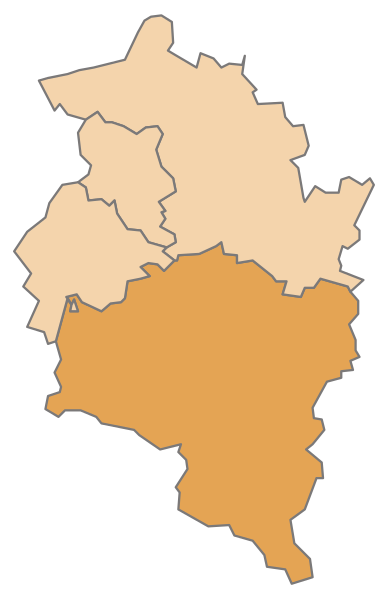
English: Map of the Austrian State Vorarlberg, highlighting Bludenz
Deutsch: Karte des österreichischen Bundeslandes Vorarlberg, Bludenz hervorgehoben |
| Dátum | |
| Zdroj | Vlastné dielo |
| Autor | AleXXw |
Licencovanie
| Ja, držiteľ autorských práv k tomuto dielu, uvoľňujem toto dielo ako voľné dielo (public domain). Toto platí celosvetovo. V niektorých krajinách to zákon neumožňuje; v tom prípade: Udeľujem komukoľvek právo používať toto dielo na ľubovoľné účely, bez akýchkoľvek podmienok ak také podmienky nevyžaduje zákon. |
História súboru
Po kliknutí na dátum/čas uvidíte ako súbor vyzeral vtedy.
| Dátum/Čas | Náhľad | Rozmery | Používateľ | Komentár | |
|---|---|---|---|---|---|
| aktuálna | 12:29, 10. júl 2010 | | 680 × 1 050 (7 KB) | AleXXw | == {{int:filedesc}} == {{Information |Description={{en|1=Map of the Austrian State Vorarlberg, highlighting Bludenz}} {{de|1=Karte des österreichischen Bundeslandes Vorarlberg, Bludenz hervorgehoben}} |Source=Eigenes Werk (own work) |Author=[[User:AleXXw |
Použitie súboru
Na tento súbor odkazuje nasledujúcich 31 stránok:
- Bartholomäberg
- Blons
- Bludenz
- Bludenz (okres)
- Bludesch
- Brand (Vorarlbersko)
- Bürs
- Bürserberg
- Dalaas
- Fontanella (Vorarlbersko)
- Gaschurn
- Innerbraz
- Klösterle
- Lech (Vorarlbersko)
- Lorüns
- Ludesch
- Nenzing
- Nüziders
- Raggal
- Sankt Anton im Montafon
- Sankt Gallenkirch
- Sankt Gerold
- Schruns
- Silbertal
- Sonntag
- Stallehr
- Thüringen
- Thüringerberg
- Tschagguns
- Vandans
- Šablóna:Obce okresu Bludenz
Globálne využitie súborov
Nasledovné ďalšie wiki používajú tento súbor:
- Použitie na als.wikipedia.org
- Bezirk Bludenz
- Bludenz
- Vorlage:Navigationsleiste Städte und Gemeinden im Bezirk Bludenz
- Bartholomäberg
- Blons
- Bludesch
- Brand (Vorarlberg)
- Bürs
- Bürserberg
- Dalaas
- Fontanella
- Gaschurn
- Innerbraz
- Klösterle
- Lech (Vorarlberg)
- Lorüns
- Ludesch
- Nenzing
- Nüziders
- Raggal
- Sankt Anton im Montafon
- Sankt Gallenkirch
- Sankt Gerold
- Schruns
- Silbertal
- Sonntag (Vorarlberg)
- Stallehr
- Thüringen (Vorarlberg)
- Thüringerberg
- Tschagguns
- Vandans
- Použitie na cs.wikipedia.org
- Použitie na de.wikipedia.org
Zobraziť ďalšie globálne použitie tohto súboru.