Súbor:Map of plebiscite area.jpg
Map_of_plebiscite_area.jpg (499 × 593 pixelov, veľkosť súboru: 100 KB, MIME typ: image/jpeg)
Zhrnutie
| Popis |
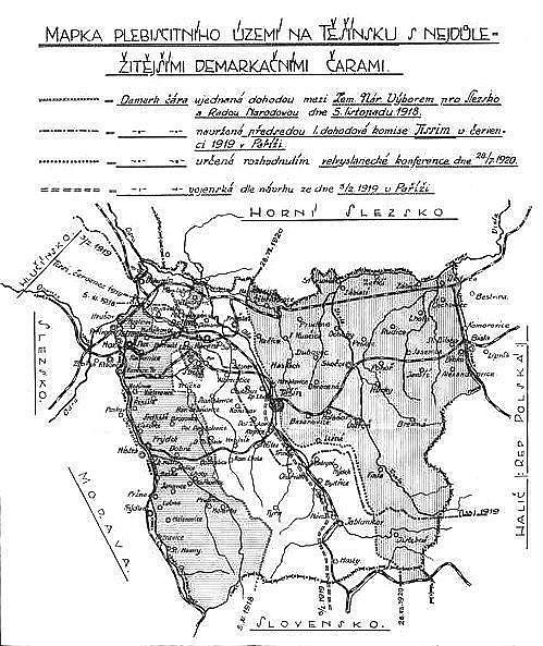
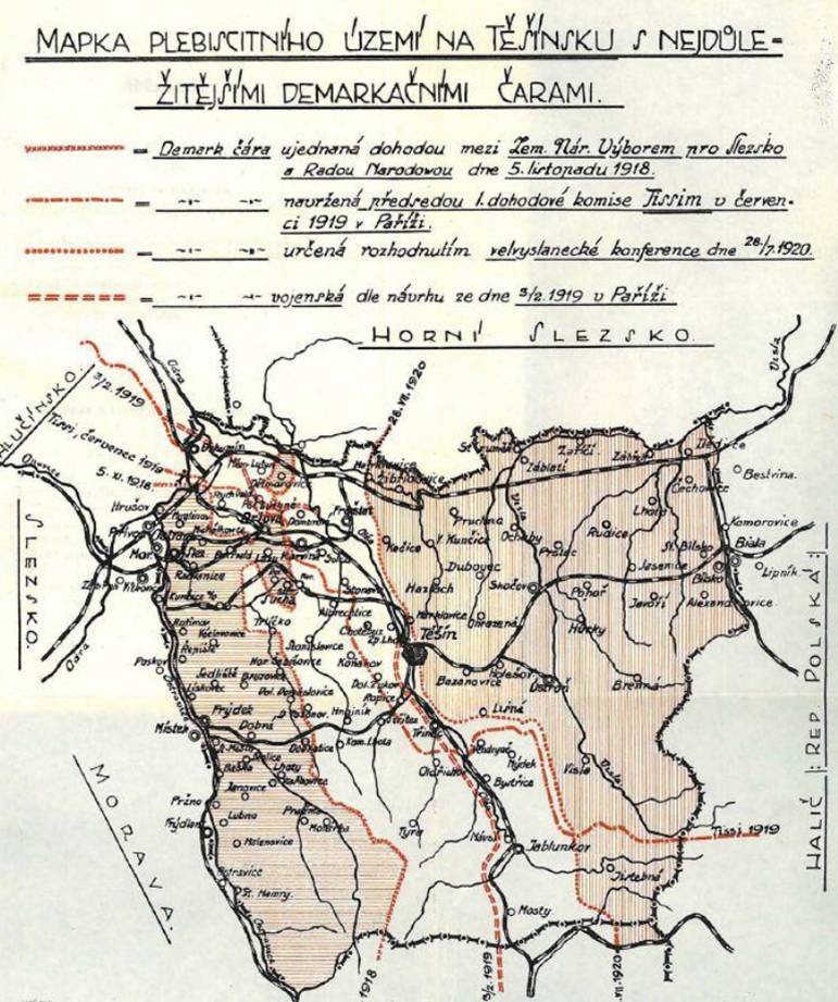
English: Map of the plebiscite area of Cieszyn Silesia during the dispute between Czechoslovakia and Poland over Teschen Silesia in 1918 - 1920. The descriptions on the map are in Czech. |
| Dátum | or before |
| Zdroj | Dr. Ferdinand Pelc: O Těšínsko. Vzpomínky a úvahy, published by Slezská Matice osvěty lidové in Slezská Ostrava in 1928 |
| Autor | Neznámý |
| Ďalšie verzie | higher resolution colour version with slightly cropped bottom |
Licencovanie
|
Toto dílo je volné také v zemích, jejichž právní řád chrání majetková autorská práva po dobu života autora a 70 let po jeho smrti.
| |
| Tento súbor bol identifikovaný, že nemá žiadne známe obmedzenia vyplývajúce z autorského zákona vrátane všetkých súvisiacich a susedných práv. | |
História súboru
Po kliknutí na dátum/čas uvidíte ako súbor vyzeral vtedy.
| Dátum/Čas | Náhľad | Rozmery | Používateľ | Komentár | |
|---|---|---|---|---|---|
| aktuálna | 14:03, 14. august 2008 | | 499 × 593 (100 KB) | MonkeymanT | {{Information |Description={{en|1=Map of the plebiscite area of Teschen Silesia during the dispute between Czechoslovakia and Poland over Teschen Silesia in 1918 - 1920. The descriptions on the map are in Czech.}} |Source=Dr. Ferdinand Pelc: O Těšínsko |
Použitie súboru
Na tento súbor odkazujú nasledujúce 2 stránky:
Globálne využitie súborov
Nasledovné ďalšie wiki používajú tento súbor:
- Použitie na cs.wikipedia.org
- Použitie na de.wikipedia.org
- Použitie na en.wikipedia.org
- Použitie na eo.wikipedia.org
- Použitie na es.wikipedia.org
- Použitie na it.wikipedia.org
- Použitie na ja.wikipedia.org
- Použitie na pt.wikipedia.org
- Použitie na ro.wikipedia.org
- Použitie na sh.wikipedia.org
- Použitie na uk.wikipedia.org
- Použitie na www.wikidata.org