Súbor:Amazonrivermap.png
Veľkosť tohto náhľadu: 600 × 600 pixelov. Iné rozlíšenia: 240 × 240 pixelov | 480 × 480 pixelov | 1 000 × 1 000 pixelov .
Pôvodný súbor (1 000 × 1 000 pixelov, veľkosť súboru: 551 KB, MIME typ: image/png)

|
K tomuto obrázku existuje vektorová verzia (v SVG).
Ak je lepšia, používajte radšej tú. File:Amazonrivermap.png → File:Amazonrivermap.svg
Podrobnejšie informácie o vektorovej grafike nájdete na stránke Commons:Transition to SVG. Taktiež si môžete prečítať informácie o podpore formátu SVG v MediaWiki. |
 |
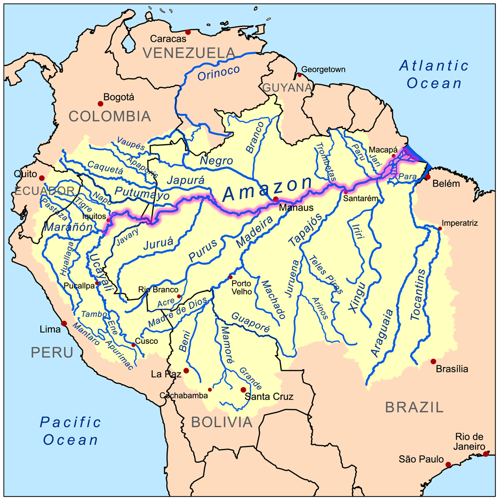
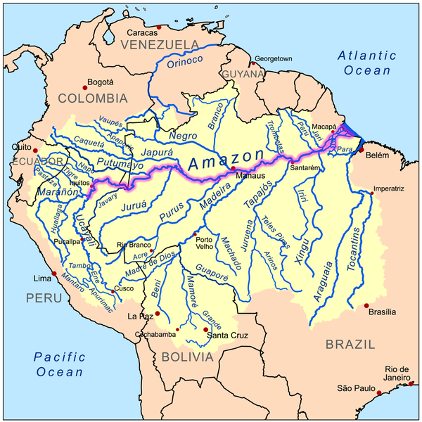
| Popis | This is a map of the Amazon River drainage basin with the Amazon River highlighted. |
| Dátum | |
| Zdroj | Own work using Digital Chart of the World and GTOPO data. |
| Autor | Kmusser |
Ja, držiteľ autorských práv k tomuto dielu ho týmto zverejňujem za podmienok nasledovnej licencie:
Tento súbor podlieha licencii Creative Commons Attribution-Share Alike 3.0 Unported
- Môžete slobodne:
- zdieľať – kopírovať, šíriť a prenášať dielo
- meniť ho – upravovať dielo
- Za nasledovných podmienok:
- uvedenie autorov – Musíte spomenúť autorov (jednotlivo alebo kolektívne), poskytnúť odkaz na licenciu a uviesť, či ste niečo zmenili. Môžete to urobiť ľubovoľným primeraným spôsobom, ale nie spôsobom naznačujúcim, že poskytovateľ licencie podporuje vás alebo vaše použitie diela.
- meniť za rovnakých podmienok – Ak toto dielo zmeníte, prevediete do inej formy alebo použijete ako základ iného diela, musíte výsledok šíriť pod rovnakou alebo kompatibilnou licenciou ako originál.
História súboru
Po kliknutí na dátum/čas uvidíte ako súbor vyzeral vtedy.
| Dátum/Čas | Náhľad | Rozmery | Používateľ | Komentár | |
|---|---|---|---|---|---|
| aktuálna | 19:02, 19. december 2022 | | 1 000 × 1 000 (551 KB) | Italyoz484 | |
| 17:04, 1. september 2022 |  | 1 000 × 1 000 (583 KB) | Wolf170278 | Tocantins doesn't belong to the amazon river basin | |
| 17:15, 8. september 2008 |  | 1 000 × 1 000 (551 KB) | Kmusser | {{Information |Description=This is a map of the Amazon River drainage basin with the Amazon River highlighted. |Source=Own work using http://www.maproom.psu.edu/dcw/ Digital Chart of the World and [[http://edc.usgs.gov/products/el |
Použitie súboru
Žiadne stránky neobsahujú odkazy na tento súbor.
Globálne využitie súborov
Nasledovné ďalšie wiki používajú tento súbor:
- Použitie na da.wikipedia.org
- Použitie na de.wikipedia.org
- Použitie na de.wikinews.org
- Použitie na en.wikipedia.org
- Použitie na he.wikipedia.org
- Použitie na ko.wikipedia.org
- Použitie na lez.wikipedia.org
- Použitie na nn.wikipedia.org
- Použitie na no.wikipedia.org