Súbor:Formigas 1849 map.png

Veľkosť tohto náhľadu: 372 × 599 pixelov. Iné rozlíšenia: 149 × 240 pixelov | 298 × 480 pixelov | 1 007 × 1 622 pixelov .
Pôvodný súbor (1 007 × 1 622 pixelov, veľkosť súboru: 4,68 MB, MIME typ: image/png)
Zhrnutie
| Popis |
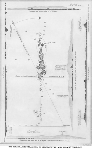
English: map of Formigas Islets, Azores, Atlantic Ocean (belong to Portugal) |
| Dátum | |
| Zdroj | https://www.jstor.org/stable/1798091 |
| Autor | Alex Vidal |
Licencovanie
|
Toto dílo je volné také v zemích, jejichž právní řád chrání majetková autorská práva po dobu života autora a 100 let po jeho smrti. | |
| Tento súbor bol identifikovaný, že nemá žiadne známe obmedzenia vyplývajúce z autorského zákona vrátane všetkých súvisiacich a susedných práv. | |
História súboru
Po kliknutí na dátum/čas uvidíte ako súbor vyzeral vtedy.
| Dátum/Čas | Náhľad | Rozmery | Používateľ | Komentár | |
|---|---|---|---|---|---|
| aktuálna | 15:24, 6. október 2012 | | 1 007 × 1 622 (4,68 MB) | Ratzer | {{Information |Description ={{en|1=map of Formigas Islets, Azores, Atlantic Ocean (belong to Portugal)}} |Source =http://www.jstor.org/stable/1798091 (costs $$) |Author =Alex Vidal |Date =1849 |Permission = |other_versi... |
Použitie súboru
Na tento súbor odkazuje nasledujúca stránka:
Globálne využitie súborov
Nasledovné ďalšie wiki používajú tento súbor:
- Použitie na ca.wikipedia.org
- Použitie na cs.wikipedia.org
- Použitie na de.wikipedia.org
- Použitie na en.wikipedia.org
- Použitie na es.wikipedia.org
- Použitie na fr.wikipedia.org
- Použitie na it.wikipedia.org
- Použitie na pt.wikipedia.org