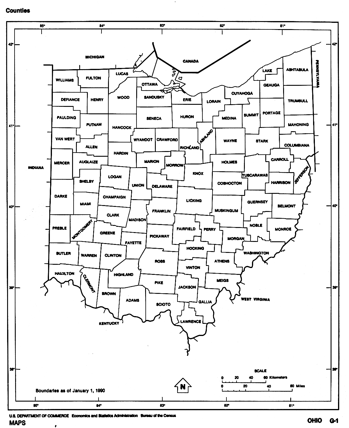
Súbor:Ohio Counties.gif

Veľkosť tohto náhľadu: 489 × 600 pixelov. Iné rozlíšenia: 196 × 240 pixelov | 391 × 480 pixelov | 626 × 768 pixelov | 1 176 × 1 442 pixelov .
Pôvodný súbor (1 176 × 1 442 pixelov, veľkosť súboru: 93 KB, MIME typ: image/gif)
| Popis | A map of Ohio counties | |||
| Zdroj | http://www.lib.utexas.edu/maps/states/ohio.gif | |||
| Autor | US Census Bureau | |||
| Povolenie (Využívanie tohto súboru) |
|

História súboru
Po kliknutí na dátum/čas uvidíte ako súbor vyzeral vtedy.
| Dátum/Čas | Náhľad | Rozmery | Používateľ | Komentár | |
|---|---|---|---|---|---|
| aktuálna | 23:32, 6. december 2007 | | 1 176 × 1 442 (93 KB) | Noddy | {{Information |Description=A map of Ohio counties |Source=http://www.lib.utexas.edu/maps/states/ohio.gif |Date= |Author=US Census Bureau |Permission={{PD-USGov-DOC-Census}} |other_versions= }} |
Použitie súboru
Žiadne stránky neobsahujú odkazy na tento súbor.