Súbor:Ph fil eastern visayas.png

Veľkosť tohto náhľadu: 384 × 599 pixelov. Iné rozlíšenia: 154 × 240 pixelov | 308 × 480 pixelov | 492 × 768 pixelov | 656 × 1 024 pixelov | 2 000 × 3 120 pixelov .
Pôvodný súbor (2 000 × 3 120 pixelov, veľkosť súboru: 137 KB, MIME typ: image/png)
Zhrnutie
| Popis |
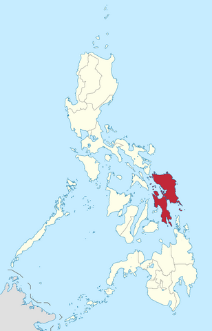
English: Location of Eastern Visayas region in the Philippines.
Filipino: Kinaroroonan ng rehiyon ng Silangang Visayas sa Pilipinas. |
| Dátum | |
| Zdroj |
BlankMap-Philippines.png by User:TheCoffee
|
| Autor | Roel Balingit |
Licencovanie
Ja, držiteľ autorských práv k tomuto dielu ho týmto zverejňujem za podmienok nasledovnej licencie:
Tento súbor podlieha licencii Creative Commons Attribution-Share Alike 3.0 Unported
- Môžete slobodne:
- zdieľať – kopírovať, šíriť a prenášať dielo
- meniť ho – upravovať dielo
- Za nasledovných podmienok:
- uvedenie autorov – Musíte spomenúť autorov (jednotlivo alebo kolektívne), poskytnúť odkaz na licenciu a uviesť, či ste niečo zmenili. Môžete to urobiť ľubovoľným primeraným spôsobom, ale nie spôsobom naznačujúcim, že poskytovateľ licencie podporuje vás alebo vaše použitie diela.
- meniť za rovnakých podmienok – Ak toto dielo zmeníte, prevediete do inej formy alebo použijete ako základ iného diela, musíte výsledok šíriť pod rovnakou alebo kompatibilnou licenciou ako originál.

|
If you choose to use this work under the Creative Commons license stated above, the author, Roel Balingit (Namayan), would like you to attribute the work to him (among other requirements such as indicating that the work is licensed under the Creative Commons) with the following text or similar:
© Roel Balingit, 2012.
His name should be a link to the Wikimedia Commons userpage Namayan. If a link is not possible, then the url should be placed in parentheses after the name. If the work has been substantially altered by other people (see the File history section below), then this particular attribution requirement is waived, which means you can attribute the work in any reasonable manner. This attribution requirement is provided pursuant to the Creative Commons Attribution mechanism where "you must attribute the work in the manner specified by the author or licensor (but not in any way that suggests that they endorse you or your use of the work)." (See "Attribution" in the Creative Commons website.)
|
História súboru
Po kliknutí na dátum/čas uvidíte ako súbor vyzeral vtedy.
| Dátum/Čas | Náhľad | Rozmery | Používateľ | Komentár | |
|---|---|---|---|---|---|
| aktuálna | 05:20, 11. február 2019 | | 2 000 × 3 120 (137 KB) | Hariboneagle927 | Reverted to version as of 03:23, 15 August 2012 (UTC) NIR no longer exists |
| 10:09, 5. jún 2015 |  | 2 000 × 3 120 (137 KB) | Namayan | Removed Region 6/7 boundaries, Negros Island Region created | |
| 03:23, 15. august 2012 |  | 2 000 × 3 120 (137 KB) | Namayan |
Použitie súboru
Žiadne stránky neobsahujú odkazy na tento súbor.
Globálne využitie súborov
Nasledovné ďalšie wiki používajú tento súbor:
- Použitie na af.wikipedia.org
- Použitie na en.wikipedia.org
- Homonhon
- San Juanico Strait
- Hernani, Eastern Samar
- Biliran, Biliran
- Caibiran
- Culaba
- Kawayan
- Maripipi
- Hinabangan
- Matuguinao
- Pagsanghan
- San Jose de Buan
- San Sebastian, Samar
- Tagapul-an
- Talalora
- Villareal, Samar
- Bobon
- Gamay, Northern Samar
- Lapinig
- Lope de Vega, Northern Samar
- Mapanas
- Mondragon, Northern Samar
- Rosario, Northern Samar
- Silvino Lobos
- Victoria, Northern Samar
- Can-avid
- General MacArthur, Eastern Samar
- Giporlos
- Jipapad
- Llorente, Eastern Samar
- Maslog
- Mercedes, Eastern Samar
- Quinapondan
- Salcedo, Eastern Samar
- Sulat
- Anahawan
- Liloan, Southern Leyte
- Pintuyan
- San Francisco, Southern Leyte
- San Ricardo
- Tomas Oppus
- Hindang
- Julita, Leyte
- Leyte, Leyte
- Mahaplag
- Matag-ob
- Mayorga, Leyte
- Tabontabon
- Panaon Island
Zobraziť ďalšie globálne použitie tohto súboru.